Richmond
A full day’s ride across the Yorkshire Dales, with plenty of sights to see too.
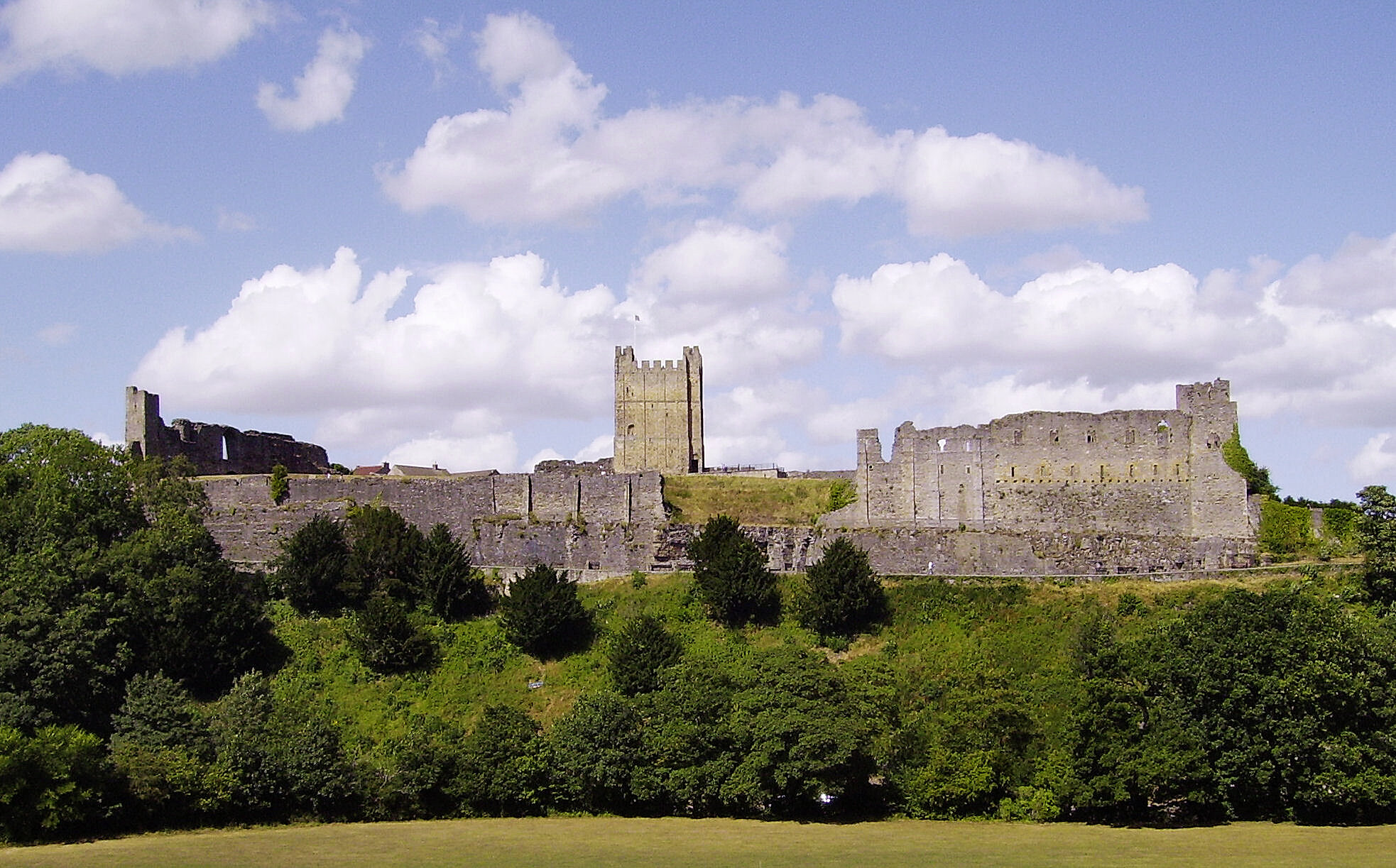
Yorkshiremen refer to their homeland as “God’s Own County” and it’s easy to see why they’re so proud of it. Get up into the Dales and you’re surrounded by nature at its grandest – all rolling hills and big skies. And those hills are crisscrossed with some astonishing roads. Our route starts in Richmond in North Yorkshire, a beautiful town dominated by its spectacular medieval castle. It’s easily reached from the rest of the country, just a few miles from the the A1.
It’s a perfect place for a weekend break – especially as it has such good riding on its doorstep.It’s not all about the roads in Yorkshire, though. Our route loops into the North Pennines, on some equally fabulous roads through an even quieter, wilder landscape. This is our idea of getting away from it all.
STAGE ONE
Richmond to Hawes:33 miles
From Richmond’s cobbled Newbiggin Square, head down the hill and over the bridge, towards Hudswell and Leyburn. You’ll reach a T-junction; turn right and it becomes the A6108 to Leyburn. As you come into Leyburn, you’ll see the King’s Head and a car park on your right – take the first right, signed for Grinton. When you get to that village, carry straight on along the B6270 through Reith. After about 11 miles — a mile after the hamlet of Muker — look for a left turn signed for Hawes.After five or six miles you’ll reach a T-junction. Turn left, then right, following the signs to Hawes. Ride through the town centre, following signs for Sedbergh.
Morning coffee: Penny Garth Café. This café on the market square in Hawes is a biking institution. Good cakes, proper coffee and great breakfasts — an ideal stop.
STAGE TWO
Hawes to Kendal: 35 miles
Carry on along Hawes high street, in the direction of Sedbergh, but when you see the national speed limit signs, turn left on the B6255 to Ingleton. This is an epic road, rollercoasting through Ribbledale, past the iconic viaduct and White Scar Caves. In Ingleton village, go straight over the first street you stop at, then turn right on the A65 to Kirkby Lonsdale. Coming into that town (watch out for the speed camera after crossing the river) take the right turn for the B6254 to the town centre.Follow the one-way system round and, when it reaches a T-junction, turn left following signs for Old Hutton. Stay on the B6254 all the way to Kendal, then follow signs for the town centre.
Lunch: Kendal. There’s parking for bikes on level one of Kendal’s underground town-centre car park (on your left where the A6 one-way system meets the river). It’s ideal for the pedestrianised heart of the town, with all its cafés. There’s loads of choice but we’d try the Joshua Tree.
VISIT: Richmond Castle. With 900 years of history and its own ghostly drummer boy, a trip to this imposing castle is a must for visitors to Richmond. It’s managed by English Heritage, with a café and gift shop. Entry costs £4.90. www.english-heritage.org.uk
STAGE THREE
Kendal to Middleton-in-Teesdale: 42 miles
From the Kendal car park, follow the A6 round towards the train station. After passing under the railway bridge, take the right turn for the A685 signed for Tebay. If you need fuel, you can nip into Tebay services, otherwise continue along the flowing A685, which takes you all the way to Brough.At the clocktower in the town centre, turn right and then, half a mile further, carry on straight as the road bends to the right, taking the B6276 to Middleton-in-Teesdale. You’ll see more sheep than cars on this road. When you drop down from the high moors, turn left at the T-junction to go into the centre of Middleton.
Afternoon tea: Café 1618. Turn left on the high street (towards High Force) and Café 1618 is just up the road, on the right.
STAGE FOUR
Middleton-in-Teesdale to Richmond: 35 miles
From Middleton-in-Teesdale town centre, take the B6282 to Barnard Castle (heading away from High Force, which you’ll see on brown signs in Middleton). In Barnard Castle, turn right on the A67 towards the centre of the town.As soon as you’ve crossed the river, turn left on the A6277 — signed for Reith and Scotch Corner.
The fast way to continue with the route is to turn right then left, across the dual-carriageway A66. However, if you’re nervous about doing this, or are riding with a large group, it may be safer to turn left first, then take the first right turn to cross the main road. You can then U-turn on the minor road and rejoin the A66, heading back towards Penrith: go past the Castle Barnard turning, then turn left to Scargill. After about seven miles on the Scargill road, turn left towards Reith. When you get to Reith, go more or less straight on the B6270 to Richmond. Stay on this road until it meets the A6108 and then, at that point, turn left to return to the start point at Richmond itself.
Start/finish – Richmond - Distance – 146 miles - Riding time: 4.5 hours