A ride around Cavalese, Dolomites
Route 10: A ride around Cavalese, Dolomites
There’s more to the Dolomites that the famous motorcycling roads in the north. Much more…
Passo Rolle: the Dolomites but without the crowds of Swiss GS riders
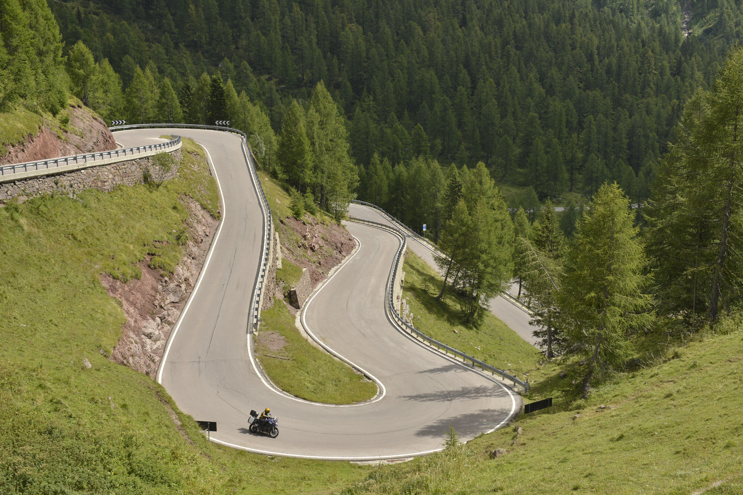
Every day it seems, Weeble has a new favourite road. Today it’s the wide and immaculately surfaced one that climbs through the ski resort called Passo Rolle, to our lunch stop at the summit. Our delayed lunch stop at the summit.
“But no, this one really is the best view”, insists Weeble as we stop to take yet another picture. “I mean, just look at it. It’s beautiful. And the corners are great. And the surface is really good. And there’s no-one here. That’s the best bit - I can’t believe how quiet it is.”
It’s true: this is an exceptionally quiet road for the Dolomites. Especially as it’s relatively well-known and is fabulous for motorcyclists to ride. It’s not as high as the big-name passes like Sella and Gau and Pordoi further north, but it’s every bit as involving and the granite peaks rising in the background are still spectacular.
It’s also a good, long pass - cramming every kind of corner into the 25-odd miles between between Predazzo and Tonadico. That means we keep stopping to take pictures, as the growls in my stomach grow louder. But it’s worth it: it is beautiful.
And that’s the joy of the Dolomites: brilliant roads that are as scenic as their more famous northern neighbours, but with less traffic.
MAPS AND DOWNLOADS FOR A RIDE AROUND CAVALESE


Route 1 (our route): start/finish: Cavalese. Distance: 170 miles. Riding time: 5.5 hours. Suggested stops: AM coffee: Passo Rolle, lunch: Ponte Mas, PM coffee: Il Tastarin
Route one map, Route one GPX file
Route 2: Distance: 190 miles. Riding time: 7 hours. Includes Passo Manghen and Monte Grappa
Route two map, Route two GPX file
Route 3: Distance: 140 miles. Riding time: 4.5 hours. Includes Carezza sea, Passo Sella and Passo di Giau
Route three map, Route three GPX file
Route 4: Distance: 220 miles. Riding time: 7.5 hours. Includes Passo Fedaia, Passo Pordoi and Passo Duran
Route four map, Route four GPX file
Please note: This page contains the route files for The RiDE Guide to motorcycle touring in Italy which came free with RiDE magazine in July 2015. These website page are not regularly updated, so please check all critical information before you travel. All route files are in .gpx format. Garmin and BMW users can download the main file, which contains all the routes and our recommended hotels as separate waypoints. TomTom users can download the individual routes and use the Tyre software to convert them. For many routes we also have Google Map links. However, as Google Maps will not plot routes over seasonally closed high Alpine passes (such as Stelvio) when they’re shut, these may not work for every route all year round.