The RiDE three-day tour of the Dolomites
The Dolomites are one of Europe’s foremost riding areas. Here’s three days in motorcycle heaven.
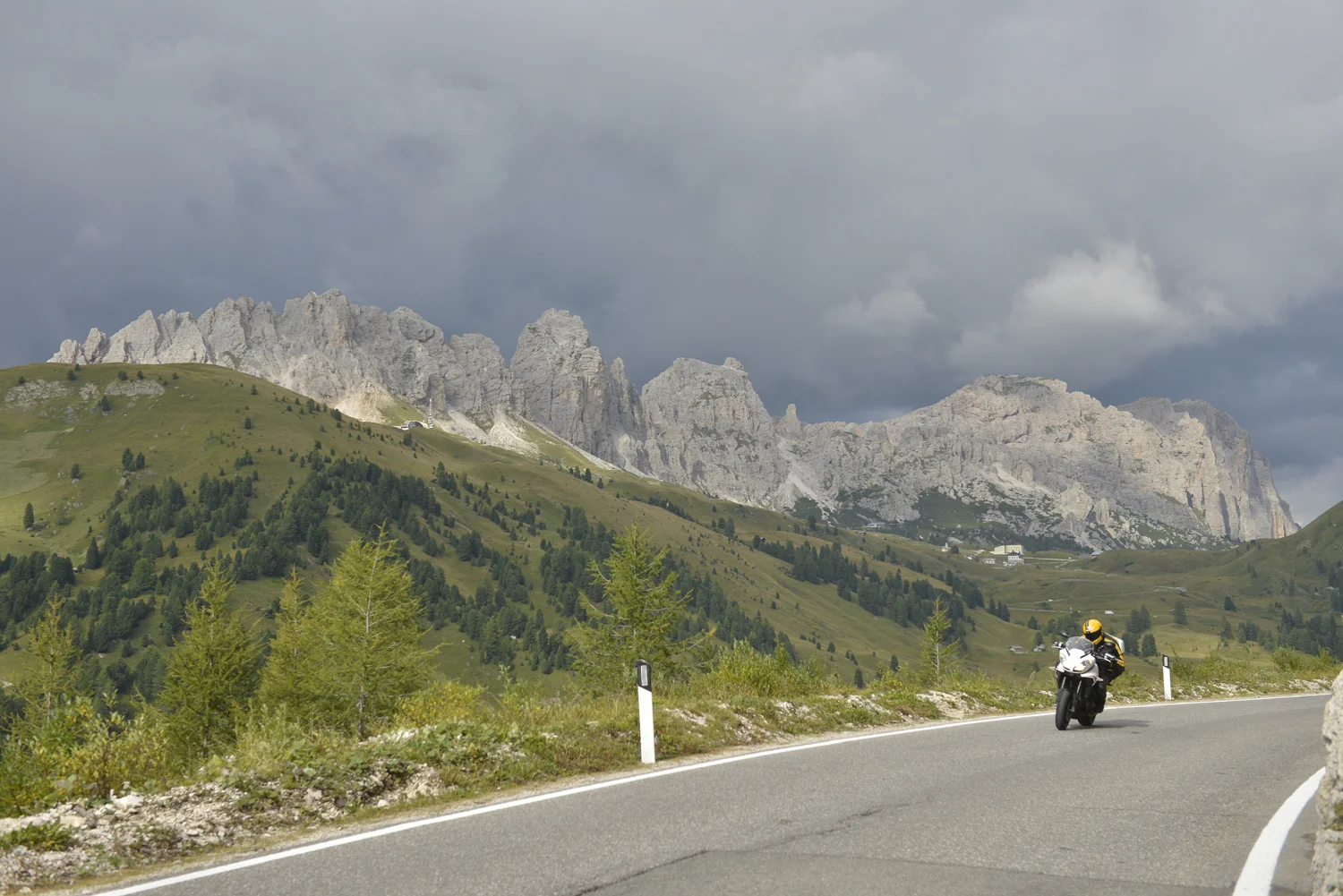
The Dolomites: just about the most scenic place to ride a bike. This is Passo Gardena
We’ve structured this as a three-day motorcycle tour, to allow three days to get to the start from the UK and three days to get back again - so the whole trip fits in with a week off work (and the two weekends). However, if you have more time, the tour can easily be extended as it stops at towns where we’ve based our daytrip routes.
The tour starts impressively and builds up fast. From Vipiteno it heads to the heart of the Dolomites, covering so many great passes - Passo di Giau, Falzarego, Gardena, Sella, Pordoi, Fedaia… It’s hard to imagine a better day on the bike. From Cortina the roads get higher and narrower, over the Sella Ciampigotto, Passo Pramollo and Monte Zonclan, on the Southern Dolomites from Maniago to Riva del Garda, including Passo Cereda and Weeble’s favourite, Passo Rolle.
We have plotted an optional fourth day, returning from Riva del Garda to Vipiteno over the Stelvio and Gavia passes. In addition, you can download the tour to run in the opposite direction from Riva to Vipiteno.
MAPS AND DOWNLOADS FOR THE RIDE TOUR OF THE DOLOMITES

Day 1: Vipiteno to Cortina d’Ampezzo. 190 miles. 6 hours
Day one map, Day one GPX file

Day 2: Cortina d’Ampezzo to Maniago. 185 miles. 5.5 hours
Day two map, Day two GPX file

Day 3: Maniago to Riva del Garda. 185 miles. 5.5 hours
Day three map , Day three GPX file
Please note: This page contains the route files for The RiDE Guide to motorcycle touring in Italy which came free with RiDE magazine in July 2015. These website page are not regularly updated, so please check all critical information before you travel. All route files are in .gpx format. Garmin and BMW users can download the main file, which contains all the routes and our recommended hotels as separate waypoints. TomTom users can download the individual routes and use the Tyre software to convert them. For many routes we also have Google Map links. However, as Google Maps will not plot routes over seasonally closed high Alpine passes (such as Stelvio) when they’re shut, these may not work for every route all year round.